Ninetrontech

UAV Data Processing

At Ninetron Tech, we transform aerial data into actionable insights with AI-powered precision. Our UAV data processing services deliver high-resolution outputs, including orthomosaics, 3D models, and volumetric analysis, tailored for industries like construction, agriculture, mining, and infrastructure. By turning drone imagery into detailed, accurate maps and models, we empower faster, smarter decision-making across every stage of your project.

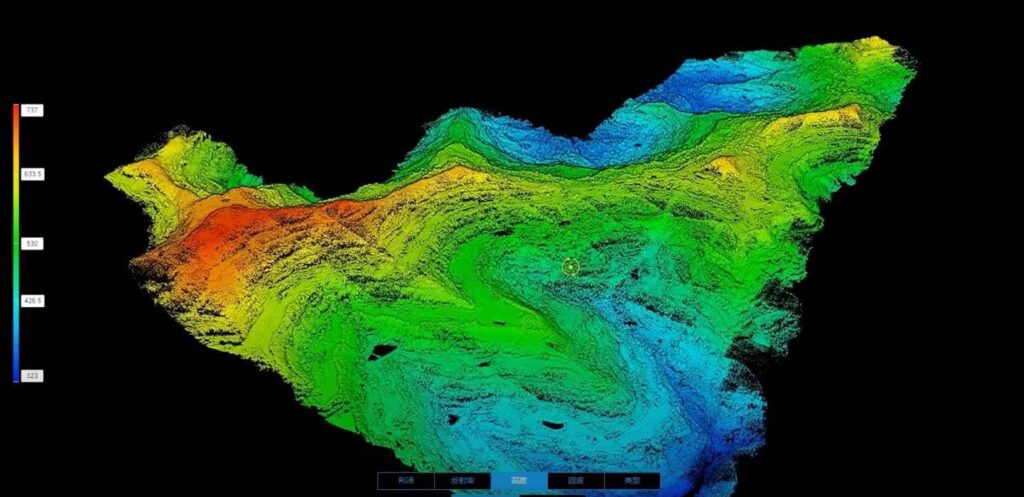
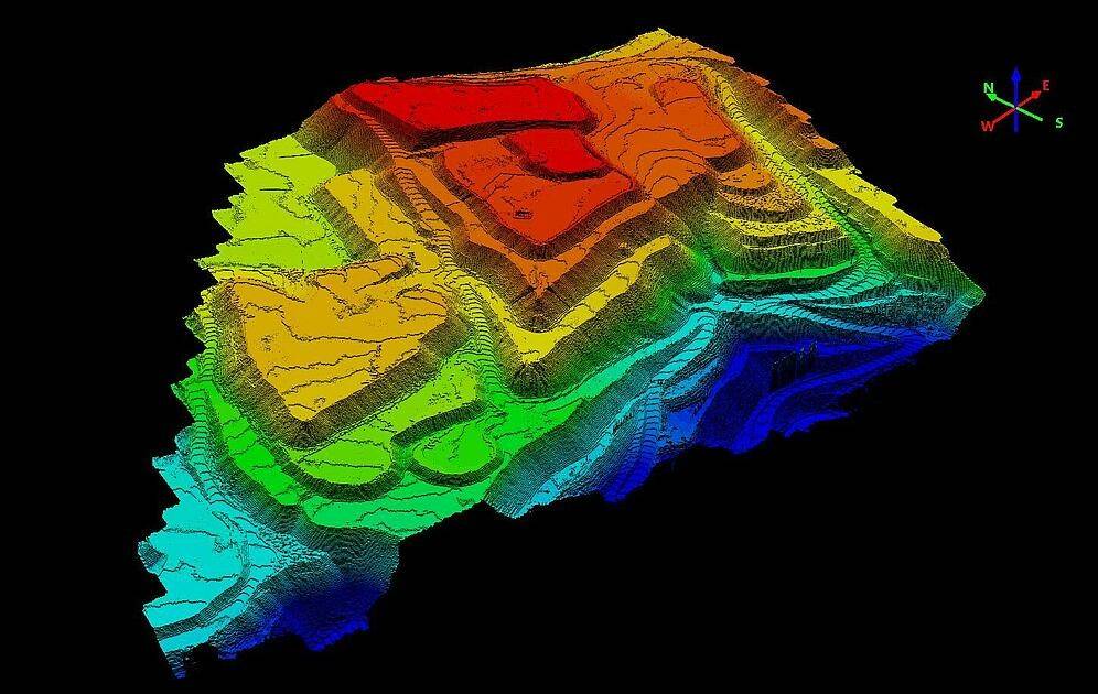
A UAV (Unmanned Aerial Vehicle) is an aircraft that operates without a human pilot onboard, either remotely controlled or autonomously guide programmed flight systems. At Ninetron maps, we lead the way in UAV innovation, offering cutting-edge drone-powered solutions through high GIS expertise, ensuring fast, reliable, and comprehensive data acquisition. We achieve centimeter-level accuracy in topographical mapping, including Digital Terrain Models (DTM), Digital Surface Models (DSM), Contour Maps, and Orthomosaic Maps, enabling cost-effective and efficient project execution. 

By integrating Artificial Intelligence and Machine Learning, we enhance data precision, achieving up to 99% accuracy in volumetric measurements, crop yield estimations, and damage detection. Our high-performance computing servers process vast aerial datasets while maintaining exceptional quality, making UAV technology indispensable across industries such as construction, agriculture, mining, infrastructure, and environmental monitoring. With Ninetrontech Drones, businesses can leverage the latest advancements in UAV mapping, aerial UAVs, and UAV data processing for smarter insights and improved decision-making. 

5x Faster Data Processing

Team of GIS Experts

Deliverables on Time

Deliverables We Provide

Orthomosaic Maps

Drone images undergo advanced correction to eliminate distortion and are seamlessly stitched together during post-processing, resulting in highly precise orthomosaic maps. Each pixel contains accurate 2D geographic data (X, Y), allowing for direct measurements of distances and surface areas with exceptional precision.

3D Point Cloud Mapping

By processing drone images into a dense 3D point cloud, we generate a highly detailed representation of the surveyed area. Every point within this cloud carries precise geospatial coordinates (X, Y, Z) and color information, enabling accurate calculations for slant distances, horizontal distances, areas, and volumes.

Digital Surface Models

Our drone technology also produces Digital Surface Models (DSM) that represent the terrain with detailed elevation data. Each pixel within the DSM contains 2D positional data (X, Y) along with the altitude (Z value) of the highest surface point, providing crucial insights for topographic analysis and infrastructure planning.

Digital Terrain Model

After filtering out objects like buildings and vegetation, drone images are processed to create Digital Terrain Models (DTMs). Each pixel in a DTM stores 2.5D information (X, Y, Z) representing the highest terrain elevation, providing accurate ground-level data for land planning, flood modeling, and engineering applications.

Contour Maps

Contour maps are generated using either DTM or DSM models, with custom contour intervals tailored to project requirements. These maps offer a detailed representation of terrain variations, aiding in topographic analysis, construction planning, and environmental assessments.

3D Textured Mesh

A 3D textured mesh is a high-fidelity model replicating the surveyed region with detailed edges, faces, vertices, and textures. This model is particularly useful for visual inspections, infrastructure planning, and stakeholder presentations, providing a realistic and immersive view of the terrain.


Get in touch with us

Talk to our team for any queries regarding drone surveying for your Industry.