Ninetrontech

Aerial Drone Surveying and Mapping

Our advanced aerial drone surveying and mapping techniques elevate your business by saving time and reducing costs while ensuring precision and efficiency.

Drone Surveying / Mapping in India

Ninetrontech Maps is committed to delivering precise and efficient aerial drone surveying and mapping services across India. Our expertise spans government and private sector projects, including land surveying, aerial mapping for land management, land slope monitoring, stockpile volumetric measurements, smart city planning, and greenfield project mapping. With a strong focus on accuracy, we consistently produce topographic maps with centimeter-level precision. Backed by advanced surveying drones and a team of skilled, licensed pilots, we ensure faster data collection and analysis, enabling informed decision-making.

Our UAV drone surveying and mapping solutions provide unmatched accuracy and reliability across various industries. As a leading drone survey company in India, we specialize in UAV-based surveying, mapping, and inspection, offering cutting-edge technology for optimal results.

Our Deliverables:

  • Orthomosaic Maps
  • 3D Point Cloud
  • Digital Surface Models (DSM)
  • Digital Elevation Models (DEM)
  • Digital Terrain Models (DTM)
  • Contour Maps
  • 3D Textured Maps

We can help with

Land Management & Development

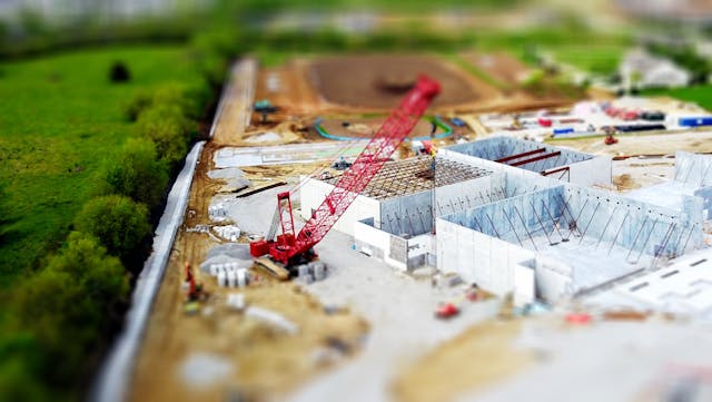
We empower organizations through precise topographic surveys that enable smarter land planning and management. Our expertise has supported numerous private and government agencies in pre-construction planning, site scouting, land allotment, and infrastructure development. By leveraging accurate aerial surveying and mapping, we deliver cost-effective solutions for roads, buildings, and utility projects ensuring that development remains aligned with strategic planning.

Land Surveying

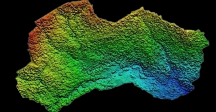
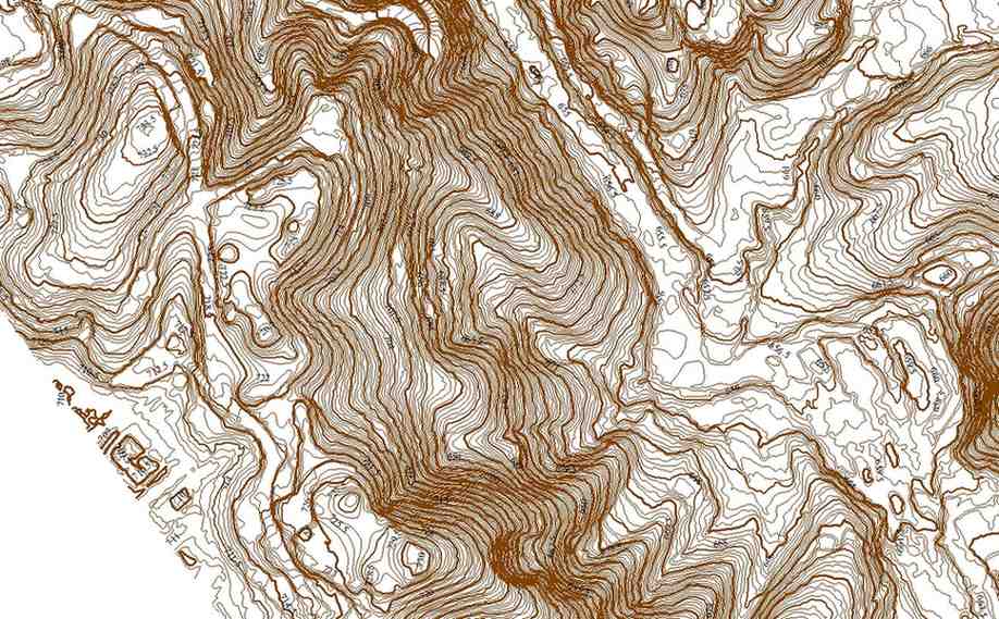
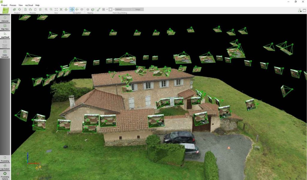
At Ninetron Tech, our advanced drone surveying solutions deliver highly accurate topographic maps and 3D models even in areas that are otherwise difficult to access. Through comprehensive land and topographical surveys, we efficiently produce precise cadastral maps with seamless execution. Our expert GIS team post-processes the survey data using advanced photogrammetry software to generate detailed deliverables, including:

  • Digital Elevation Models (DEM)
  • Digital Terrain Models (DTM)
  • Contour & Brake Line Mapping
  • Orthomosaic & Ortho-imagery
  • Interactive 3D Models & Reconstructions

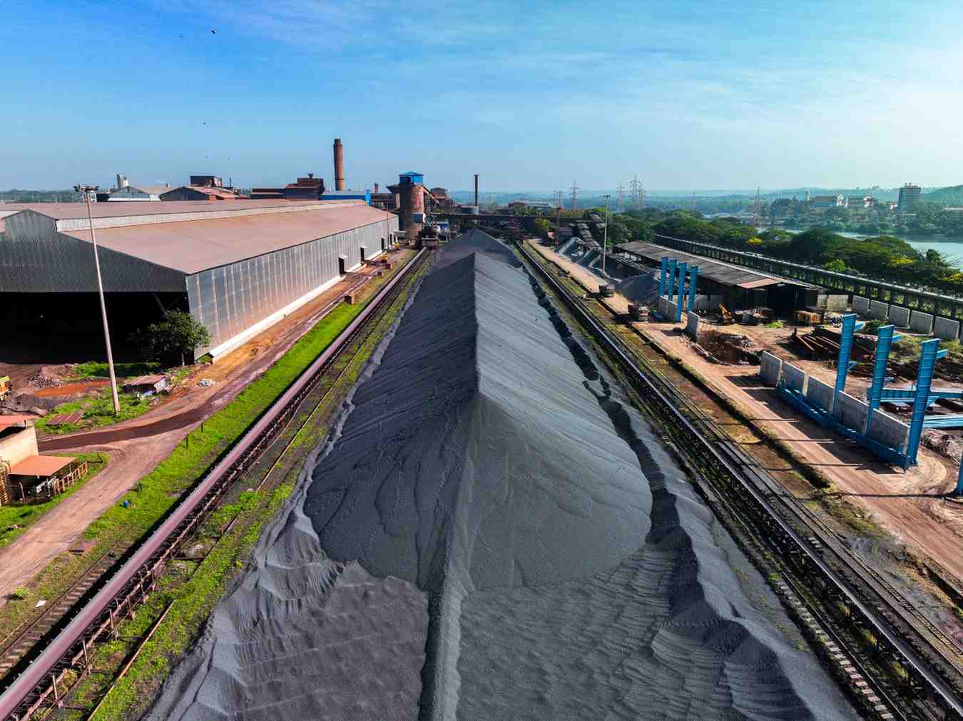
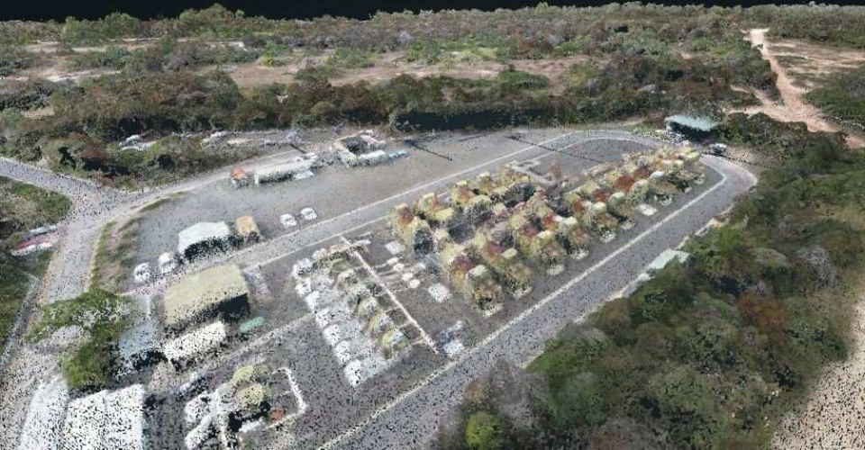
Stockpile Volumetric Measurements

Drones have revolutionized stockpile measurements, offering a faster and more precise alternative to traditional methods. Our advanced surveying drones capture intricate topographic data, including irregular stockpile shapes that conventional techniques often miss. With nearly 99% accuracy, we deliver photogrammetric insights for industries such as mining, waste management, agriculture, and inventory control. Our solutions include:

  • Contour Mapping
  • Digital Surface Models (DSM)
  • Accurate Volume Calculations for Stockpiles

Slope Monitoring

Infrastructure projects built near natural or man-made slopes such as highways, railways, bridges, embankments, tunnels, and dams are exposed to the risk of slope failure. At Ninetron Tech, we offer advanced drone-based slope monitoring services that help you detect early signs of instability, reduce downtime, and ensure public safety.
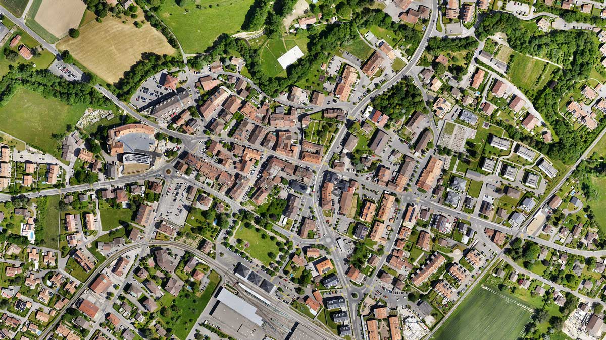
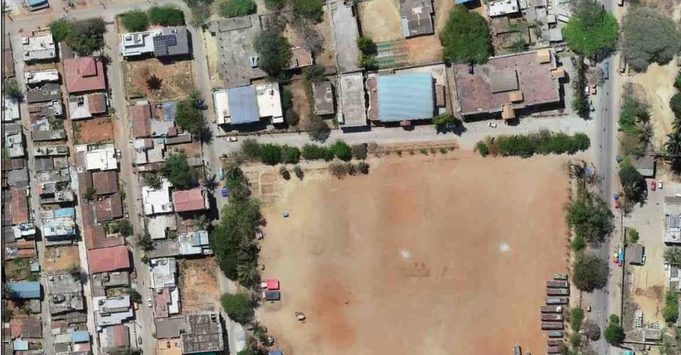
Urban Planning

With advancements in drone technology, urban planning has become more data-driven and cost-effective. Our AI-powered drones rapidly collect vast amounts of high-resolution aerial data, enabling private developers and government agencies to assess environmental and social conditions efficiently. Using LiDAR and aerial mapping, we provide vital insights to aid city planners in designing sustainable and well-structured urban landscapes.

Deliverables We Provide

Orthomosaic Maps

Drone images undergo advanced correction to eliminate distortion and are seamlessly stitched together during post-processing, resulting in highly precise orthomosaic maps. Each pixel contains accurate 2D geographic data (X, Y), allowing for direct measurements of distances and surface areas with exceptional precision.

3D Point Cloud Mapping

By processing drone images into a dense 3D point cloud, we generate a highly detailed representation of the surveyed area. Every point within this cloud carries precise geospatial coordinates (X, Y, Z) and color information, enabling accurate calculations for slant distances, horizontal distances, areas, and volumes.

Digital Surface Models

Our drone technology also produces Digital Surface Models (DSM) that represent the terrain with detailed elevation data. Each pixel within the DSM contains 2D positional data (X, Y) along with the altitude (Z value) of the highest surface point, providing crucial insights for topographic analysis and infrastructure planning.

Digital Terrain Model (DTM)

After filtering out objects like buildings and vegetation, drone images are processed to create Digital Terrain Models (DTMs). Each pixel in a DTM stores 2.5D information (X, Y, Z) representing the highest terrain elevation, providing accurate ground-level data for land planning, flood modeling, and engineering applications.

Contour Maps

Contour maps are generated using either DTM or DSM models, with custom contour intervals tailored to project requirements. These maps offer a detailed representation of terrain variations, aiding in topographic analysis, construction planning, and environmental assessments.

3D Textured Mesh

A 3D textured mesh is a high-fidelity model replicating the surveyed region with detailed edges, faces, vertices, and textures. This model is particularly useful for visual inspections, infrastructure planning, and stakeholder presentations, providing a realistic and immersive view of the terrain.


Our Features

Faster Data Acquisition

Our skilled drone pilots utilize high-precision UAVs, enabling us to capture aerial survey data 10 times faster than conventional methods.

5x Faster Delivery

With a dedicated team of GIS experts working around the clock, we ensure on-time or early delivery of processed drone survey data.

99% Accurate Measurement

Leveraging Machine Learning and AI, we achieve up to 99% accuracy in yield estimation, volumetric analysis, and topographic mapping.

Advance Equipment

We use high-end and custom-built drones equipped with advanced sensors to deliver superior-quality data for every project.

Team of Experts

Our GIS engineers, licensed drone pilots, and software experts collaborate to provide you with the most precise and efficient surveying solutions.

One to One Support

From project initiation to completion, we offer comprehensive client support, ensuring seamless decision-making with high-quality survey data.

Industries benefiting from Aerial Surveying

Get in touch with us

Talk to our team for any queries regarding drone surveying for your Industry.