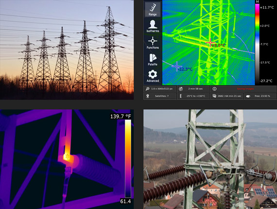
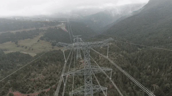
Power Line Inspection
Our drone-powered aerial inspection enables precise identification of critical issues such as tower concrete basement defects, insulator overheating, wire overheating, wire breaks, tower mechanical defects, and wire sag estimation. Equipped with ferro-magnetic protection, our power line inspection drones can safely operate near power lines with high accuracy.
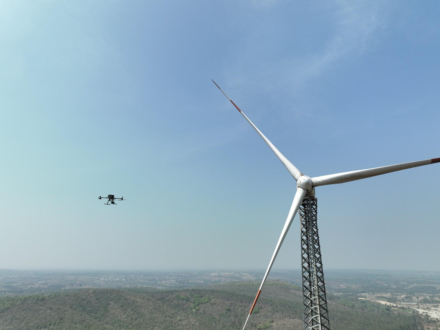
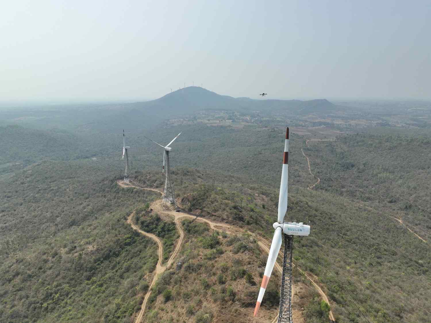
Wind Turbine Inspection
We help wind farm clients enhance efficiency, reduce downtime, and improve turbine safety through advanced drone-based turbine and blade inspections. Our skilled drone pilots conduct in-depth inspections, detecting issues up to 15cm deep within turbine blades and identifying defects as small as 4mm.
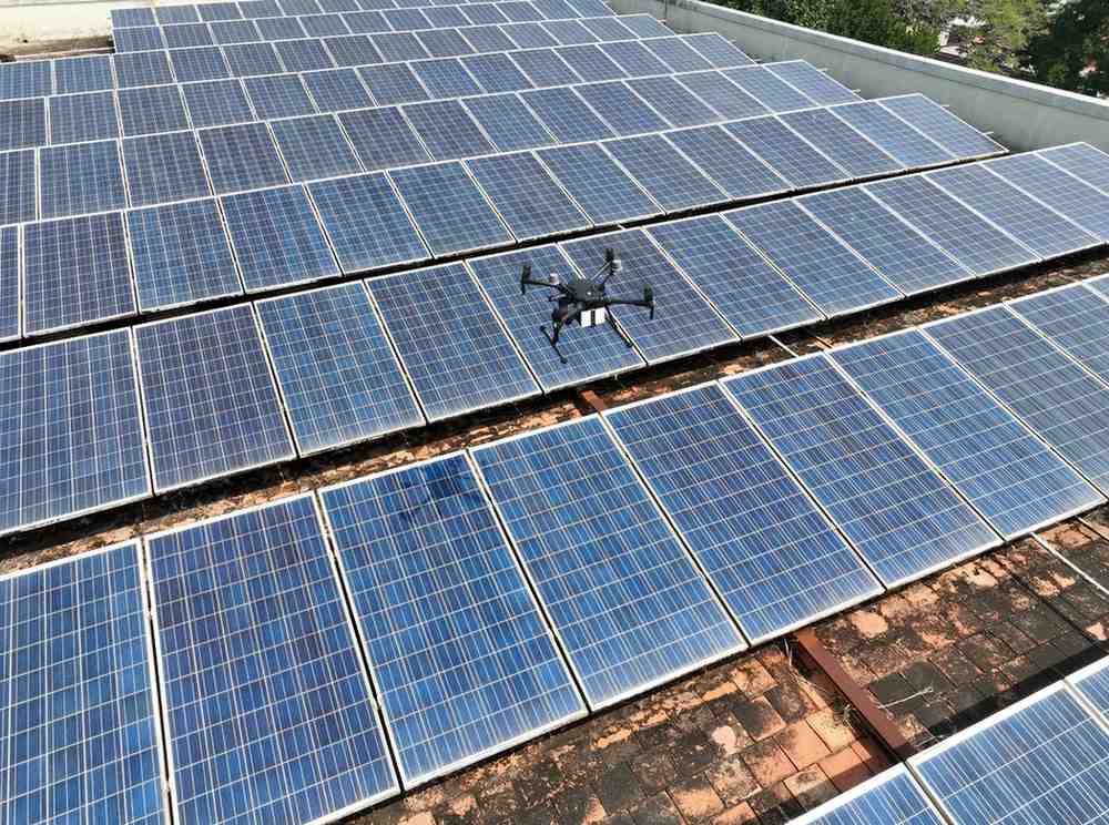
Solar Panel Inspection
Our innovative drone solutions help solar farm clients maximize efficiency, optimize energy production, and accelerate ROI. By capturing high-quality thermal data, we enable early detection of cell failures, solar cell degradation, and operational efficiency losses. Our drones are equipped with advanced thermal sensors to ensure superior inspection accuracy.
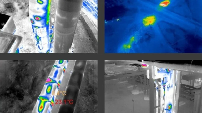
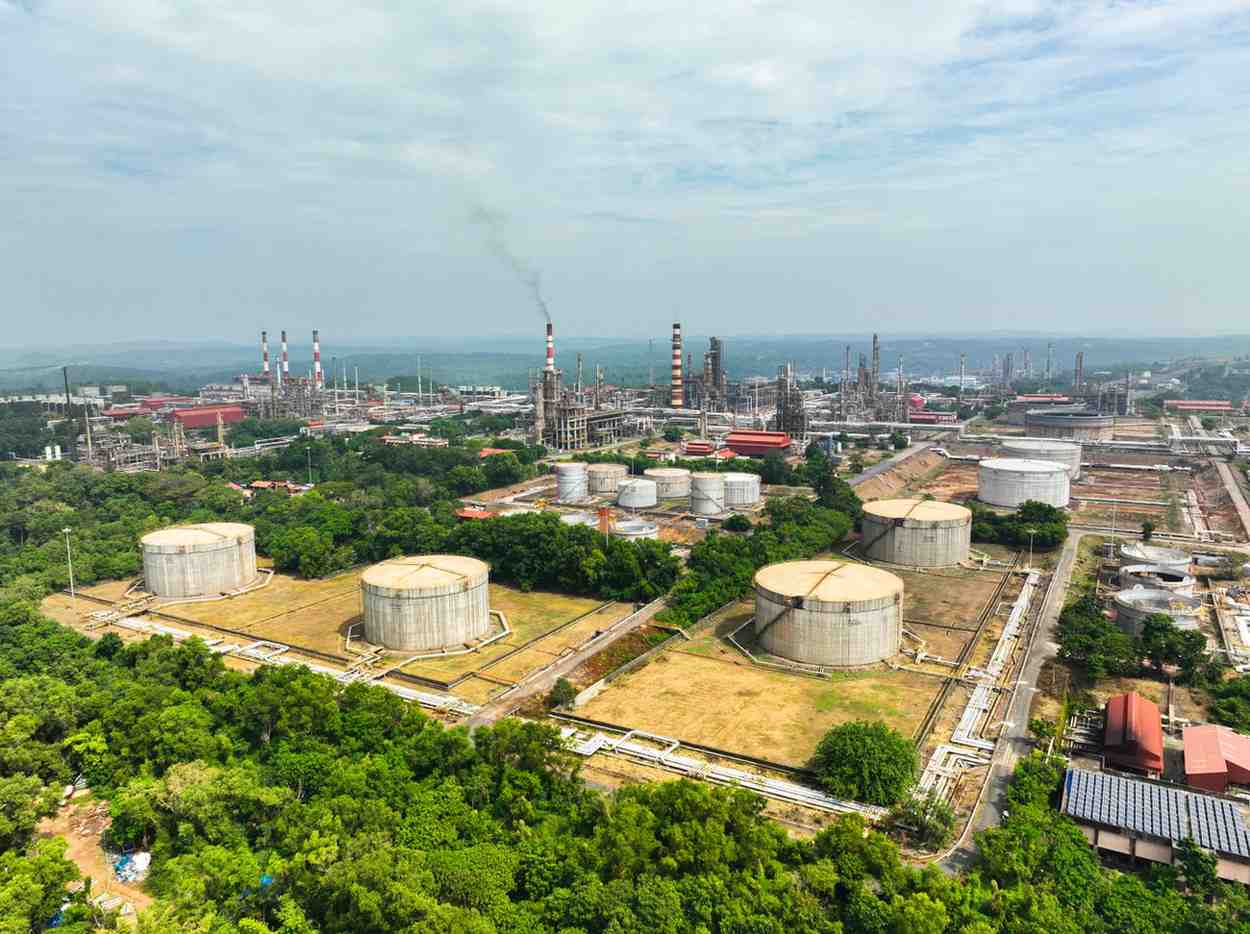
Gas & Oil Pipeline Inspection
Our aerial oil and gas pipeline inspections offer a safer and more efficient alternative to traditional methods. We assist oil and gas companies in detecting pipeline erosion, monitoring elevation changes, inspecting above-ground pipeline assets, detecting spills, and ensuring overall pipeline management.
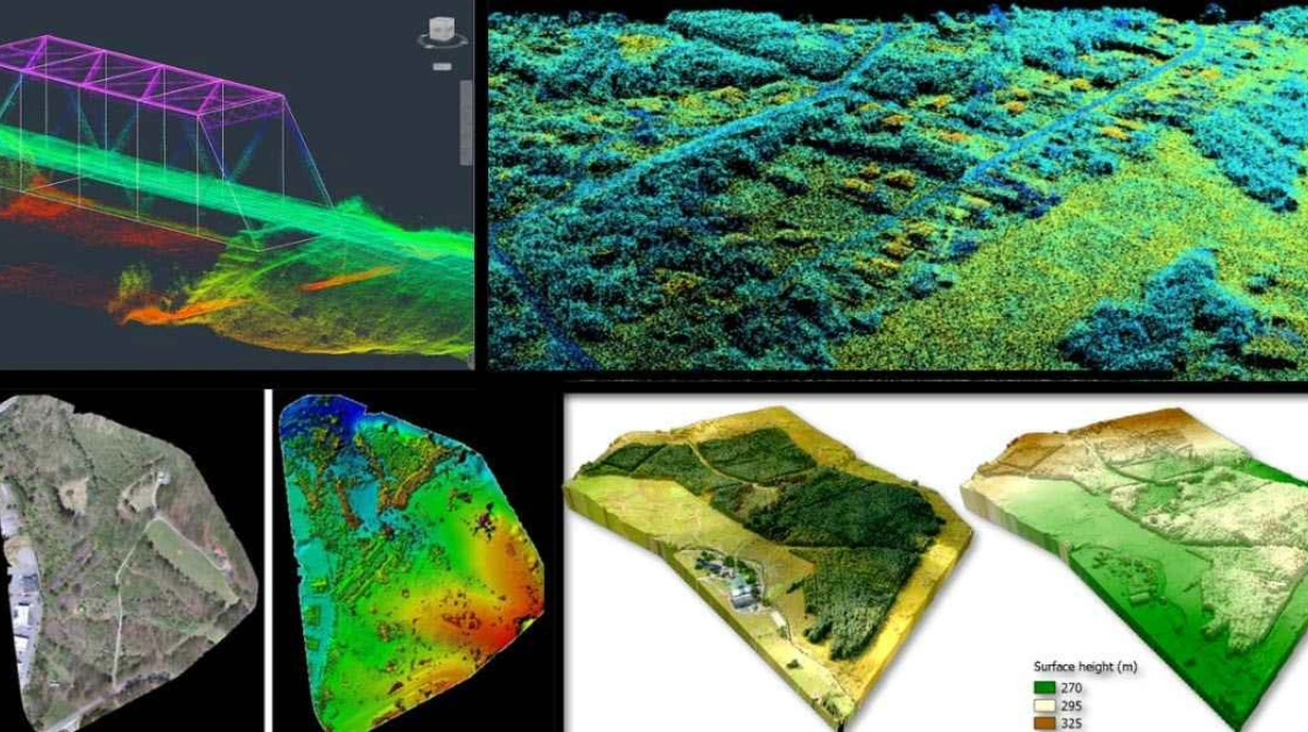
Bridge Inspection
Aerial drone inspections provide a cost-effective and efficient solution for assessing busy highway and railway bridges. Our experienced drone pilots use high-end drones to capture superior-quality aerial data, enabling precise inspections while prioritizing public and crew safety.
Railway Track Inspection
Drone inspections are the ideal solution for routine railway track maintenance and inspections. We conduct comprehensive assessments of critical track components, including switch motors, points levers, point machines, conversion facings, point locks, joints, and guard rails, ensuring optimal railway performance and safety.
Cooling Tower Inspection
Regular maintenance and inspection of cooling towers are essential for extending their lifespan and preventing potential disasters. Our drones, equipped with advanced sensors, conduct fast and precise aerial inspections, eliminating the risks associated with time-consuming and hazardous manual inspections.

Monument Inspection
Preserving historic buildings and monuments is vital for maintaining cultural heritage. Our aerial drone inspections provide high-quality data, enabling in-depth and accurate assessments of structural integrity. Periodic inspections help monitor and maintain the longevity of these structures.
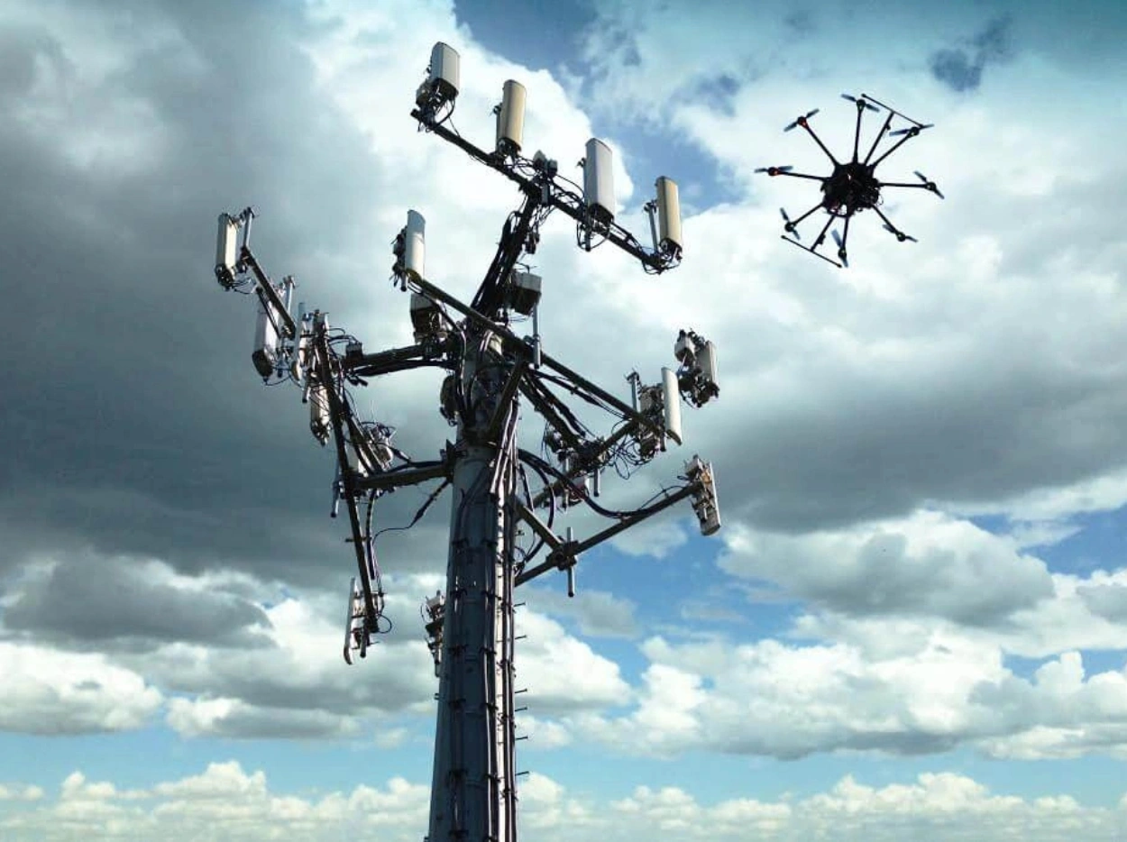
Cell Tower Inspection
Our aerial inspection services help cellular companies identify structural damage, potential hazards, and equipment issues within cell tower infrastructure. By leveraging drone data, clients can proactively mitigate operational failures, improve efficiency, and reduce maintenance costs.
Post Processed Drone Video
Drone videos provide our clients with a comprehensive overview of their critical assets. Our expert editing team enhances these videos through meticulous post-processing, ensuring that every key detail is highlighted. These highly informative drone videos support decision-making by helping clients prevent operational failures, mitigate risks, enhance safety, maintain structural integrity, and optimize efficiency and production.
Drone Image
Our drones are equipped with advanced sensors, including thermal and RGB image sensors, capable of capturing high-resolution 4K images. We provide clients with aerial data of hard-to-reach areas, offering a detailed view of their assets. This data enables clients to assess asset conditions under load and effectively monitor their critical assets over time.