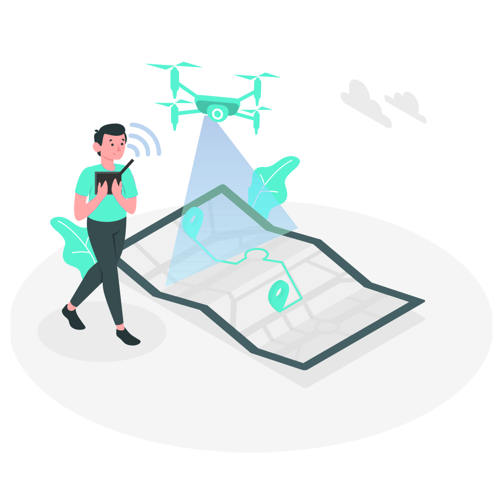
Turning ideas into reality with the best drone technology
We use drones to capture high-quality aerial images that help businesses work more efficiently, reduce costs, and manage important tasks with ease.
We Are Ninetron Maps
At Ninetron Maps, we specialize in delivering high-quality Geo-Spatial solutions with unmatched speed and precision for both public and private sectors. Our expertise spans GIS surveying, drone inspections, mining services, flood assessments, crop health monitoring, topographic surveys, UAV data processing, 3D mapping, and aerial photography.With a skilled team that includes wind turbine experts, we provide specialized drone services across India, ensuring accuracy, reliability, and efficiency. Backed by extensive experience, strong teamwork, and advanced technology, we have established ourselves as a leading name in drone mapping and surveying, delivering top-tier solutions across diverse industries.

Get Data Faster
Our skilled drone pilots and advanced UAV technology enable us to collect data up to 10 times faster than traditional methods.

Precise Surveys
Using smart technology and advanced drones, we produce maps and measurements with up to 99% accuracy.

Leading in Industry
Our dedication and excellence have established us as a leading company in the drone industry.
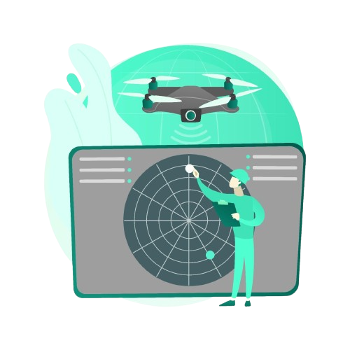
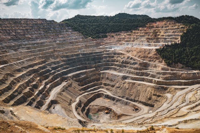
What We Offer

Surveying / Mapping
We offer a comprehensive range of services, including GIS, drone surveys, land surveys, stockpile volumetric analysis, slope monitoring, LiDAR, contour mapping, and urban planning. Our high-precision deliverables such as orthomosaic maps, 3D point clouds, digital elevation models (DEM), and digital terrain models (DTM) provide actionable insights. Utilizing advanced UAV survey techniques, we deliver volumetric analysis with up to 99% accuracy, making us a trusted choice for reliable surveying and mapping solutions.

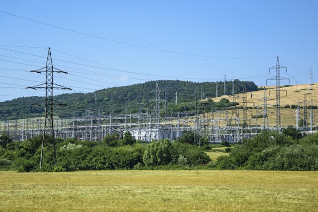
Aerial Inspection & Analysis
We provide aerial inspection services for infrastructure, powerlines, wind turbines, solar panels, bridges, and railways using both visual and thermal imaging to detect and analyze asset damage. As leaders in UAV inspection, we deliver comprehensive assessments and precise aerial surveys, ensuring reliability and operational efficiency across a wide range of industries.

Creative Aerial Content
With our advanced aerial photography drones and expert editing, we create stunning cinematic drone videos for real estate and sports events. Our high-quality drone photography enhances property listings with captivating visuals, ensuring top-tier results for real estate marketing and property showcases.

UAV Data Processing
We leverage a team of GIS experts and high-performance computing to process and map large-scale geospatial datasets. Our deliverables include orthomosaic maps, 3D point clouds, digital terrain models (DTMs), digital surface models (DSMs), and detailed contour maps. Using advanced UAV technology, we provide precise, high-quality drone surveying and mapping solutions tailored to meet diverse project needs.
INDUSTRIES SERVED

Transportation
We support railway and highway projects with GIS solutions, topographic surveys, and UAV-based inspections. Our drone technology enables precise assessments of roads and bridges, utilizing advanced sensors for reliable and high-resolution data collection.

Renewable Energy
Enhance data accuracy and reduce risks in solar and wind turbine inspections with AI-powered surveys and thermal mapping. Our advanced drone solutions ensure precise assessments for solar and wind energy assets, optimizing performance and reliability.

Mining
Monitor critical assets with AI-powered volumetric analysis at 99% accuracy. Our UAV solutions enable 30x faster data collection for haul road optimization, mine exploration, and mining inspections, ensuring efficient and precise results.

Utilities
We provide GIS services, topographic surveys, and UAV inspections for railway and highway projects, ensuring accurate and efficient assessments. Our advanced drone solutions capture precise road and bridge data using advanced sensors.

Infrastructure
Our GIS experts enhance your projects with advanced UAVs for 3D city models, aerial surveys, drone inspections, and traffic analysis. We provide precise infrastructure assessments, ensuring detailed insights for better project planning and execution.

Agriculture
We leverage aerial surveys, mapping, and advanced UAVs for precision agriculture, including crop health analysis, irrigation planning, damage assessment, and soil analysis with 98% accuracy. Our drone solutions enhance efficiency in modern farming operations.

Oil and Gas
Oil and gas companies use drones for pipeline inspections and asset monitoring, ensuring safety, accuracy, and cost efficiency. Our specialized drone solutions provide reliable inspection services for the oil and gas industry.

Real Estate
Real estate drone photography enhances property listings with high-quality aerial visuals, attracting buyers and investors. Our specialized drone services capture stunning images and videos, showcasing properties effectively.
FAQ's
Why Drone Survey?
Drone surveys capture accurate data from hard-to-reach areas, delivering high-resolution orthomosaics and detailed 3D models. They enhance decision-making in construction, infrastructure inspection, and mapping, while improving safety by minimizing the need for at-height manual work.
How accurate Drone Survey results are?
One fundamental parameter of drone surveying is a spatial presentation, typically known as GSD (Ground Sampling Distance) in photogrammetry terms. In brief, it symbolizes the interval amongst two consecutive pixel centers on the ground. GSD relies on the resolution, focal range, and flight elevation of the drone camera. Ninetron Maps use professional surveying dronesĀ to attain 1cm level accuracy in our surveying results.
Which drone survey technology do we use?
Drones have become essential tools for both private and governmental organizations, thanks to their wide range of applications. We have established a strong presence across industries by delivering fast, reliable, and safe operations. From military bases to agricultural land mapping, our technology stands out for its precision and efficiency. By leveraging advanced survey drones, AI integration, and cutting-edge sensors, including thermal, RGB, and LiDAR, we deliver innovative, tailored solutions to meet diverse operational needs.
What is the process around each drone operation?
Each project demands a tailored drone operation plan. For instance, in aerial photography, we follow a structured approach:
- Research & Development: Gathering project data, studying aviation charts, and assessing environmental factors to identify risks.
- Planning: Defining project scope, selecting equipment, allocating personnel, and estimating costs.
- Execution: Conducting pre-flight checks and implementing the operation as per requirements.
- Analysis: Processing data with specialized software for technical insights, while video editors enhance visuals for optimal results.
What are the current applications for Aerial Technology?
Aerial technology plays a vital role in various sectors, including aerial photography and videography, surveys, traffic monitoring, military surveillance, construction, power line inspections, agriculture, healthcare, logistics, and solar and wind turbine maintenance.
Why are using drones for surveying superior compared to traditional methods?
UAVs and drone surveying provide detailed data from remote or hazardous locations efficiently and cost-effectively. Compared to traditional methods, they offer faster, safer, and more practical solutions with exceptional accuracy.