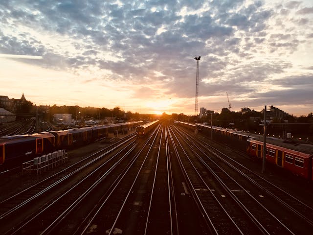
Railways
Save time, enhance efficiency, and ensure safety with our drone-powered solutions.
Railways
Drone survey, inspection and monitoring for the transport industry
Ninetron’s cutting-edge drone technology revolutionizes railway and roadway infrastructure management. We assist agencies in project planning, construction monitoring, and infrastructure inspection using high-end surveying drones equipped with high-resolution sensors. Our dedicated drone pilots and GIS experts consistently deliver precise data, often ahead of schedule, with centimeter-level accuracy.
We provide a wide range of aerial survey data, including orthophotos, elevation models, terrain models, 3D models, and thermographic data. These insights help maximize efficiency and ensure accountability in railway and highway projects.
Comprehensive Aerial Inspection Services
We offer periodic aerial inspections that help railway and roadway agencies track critical assets, prevent damage, and enhance operational safety. Our drone-powered inspections include:
- Railway track inspection
- Railway infrastructure inspection
- Bridge inspection
- Roadway condition monitoring
- Highway safety assessments
With experienced pilots and advanced UAV technology, we collect aerial data efficiently while ensuring compliance with safety standards, even in high-traffic areas, without disrupting operations.
Planning
Pre Construction Survey
Our high-end drones hover at speeds of 20-50 mph to conduct extensive aerial surveys, allowing railway agencies to assess land viability for new tracks, stations, and yards. Using topographical maps, 3D models, and GIS data, we provide insights into:
- Utility lines
- Drainage slopes
- Terrain conditions
- Existing risks for new railway projects
Construction
Project Progress Monitoring
Our aerial construction monitoring solutions enable railway project managers to:
- Reduce construction time and costs
- Maintain high safety and quality standards
- Identify unfinished overbridge pillars, half-built structures, and other construction elements
With real-time aerial footage and expert data processing, we provide accurate progress tracking to streamline project execution.
Asset management
Volume Estimation
Effective asset tracking is crucial in railway construction. Using drone-powered aerial surveys and machine learning, we achieve 99% accuracy in stockpile volume estimation. Our advanced technology assists project managers in:
- Monitoring stock materials
- Optimizing resource allocation
- Improving overall project efficiency
Inspection
Railway Buildings & Bridges
Drone inspections provide safe and cost-effective assessments of railway bridges and buildings. Our high-resolution imaging and 3D modeling ensure structural integrity analysis without endangering personnel.
Inspection
Railway Track
Scheduled drone inspections enhance railway track maintenance by:
- Identifying track length and potential hazards
- Conducting thermal and structural inspections
- Generating topographical maps, 3D models, and orthoimagery
Inspection
TSS & Level Crossing
Our aerial inspections, 10x faster than traditional methods, provide complete visual data for:
- Level crossings – Ensuring safety at railway-road intersections
- Traction substations – Detecting vegetation growth, equipment failures, and security risks
Our Features
500+ km Railway Track Covered
Supporting project managers with extensive aerial insights
Up to 50 km Railway Line Surveyed Daily
With skilled pilots and high-end survey drones
Faster Data Delivery
Our GIS experts work round-the-clock to ensure timely data processing
Why Choose Drone-Based Railway Inspections?
- Higher-Resolution Visual Inspections
- Enhanced Efficiency & Faster Data Collection
- Safe Monitoring of Inaccessible Infrastructure
- Cost & Time Savings
- Improved Personnel Safety